Grand Canyon National Park (South Rim)

March 22, 2019
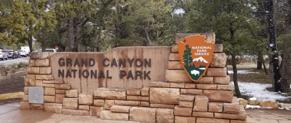
South Entrance
The South Entrance is the main access point for the vast majority of people visiting Grand Canyon National Park. Located about 60 miles north of Williams, Ariz., it is the gateway to the South Rim, home to many of the park’s best-known manmade attractions like the El Tovar Hotel and the park headquarters.
Grand Canyon Visitor Center

Mathers Point
Many park visitors get their first good look at the Grand Canyon from Mather Point, since it’s just a short walk from Canyon View Plaza and the main visitor’s center.

From a pair of overlooks protected by railing you can see Garden Creek, Bright Angel Creek, and portions of the Bright Angel, South Kaibab, and Tonto trails. You can also pick up the South Rim Trail here, and Mather Point is a popular spot for watching the sun rise over the North Rim in the morning.

Yavapai Point
The northernmost point on the South Rim, Yavapai Point provides you with dramatic vistas as far east as Desert View. Bright Angel Canyon lies straight ahead, and you also can catch a glimpse of the Colorado River. Across the canyon you’ll see the prominent summit of Isis Temple and the nearby Cheops Pyramid, actually a flat-topped mesa.

Look west to see the Shiva Temple, below which Trinity Creek runs to meet the Colorado River near Hopi Point. To the east is Clear Creek, O’Neill Butte, and Cedar Ridge

Pipe Creek Vista


Duck on a Rock


Grand Viewpoint
The vistas from this spot live up to their name: the U-shaped Horseshoe Mesa is the most prominent feature, bracketed by Grapevine and Cottonwood creeks.


What you won’t see are many traces of the colorful history of the Grandview Point area, which was home to a gold, copper and silver mine and the Grand Canyon’s first tourist hotel in the 1890s.


After the El Tovar was built at the Grand Canyon Village, newspaper magnate William Randolph Hearst bought the mine and hotel property and used it as a family retreat. The hotel is long gone, but some of the mining artifacts remain on Horseshoe Mesa.


Coronado Butte
A mountain summit located at an elevation of 6,919 feet.

Moran Point
Named for landscape painter Thomas Moran, this is one of the most popular Grand Canyon spots for photographers and painters. Red Canyon is directly below Moran Point, and looking out over the abyss you may even see rapids on the Colorado River.

Gaze at the canyon walls and try to identify the three main rock groups in the Grand Canyon: Layered Paleozoic Rocks, the elusive Grand Canyon Supergroup, and the ancient Vishnu Basement Rocks

Tusayan Museum and Ruins
The Tusayan Museum exhibits include information on life in the Pueblo tribal village that stood here 800 years ago, as well as a collection of artifacts gathered from the village site.

Look for the collection of split-twig figurines of deer, bighorn sheep, and other animals: these ancient handicrafts were shaped from single twigs 2,000 to 4,000 years ago, and were discovered in Grand Canyon caves.


There are paved and gravel trails behind the museum to view the remains of the village itself, which included a large and small kiva, or ceremonial center, as well as living areas, grain storage rooms, and a farm.


Lipman Point
From this vantage point you can look west to see Seventy-five Mile Creek running alongside a ridge connected to Escalante Butte. The creek reaches the Colorado River between the Neville and Hance rapids, which you may be able to spot from here. Also look for the 2,000-foot cliffs of Pinal Point. To the east is the Unkar Delta, fed by Unkar Creek, a waterway that runs past several ancient Pueblo Indian ruins whose inhabitants once farmed in the delta.


Desert View Watchtower


**********************************************************************************************
This post contains affiliate links, so I make a small commission if you purchase through my links – that support helps to keep this blog running.
Copyright Foodie Made Simple, LLC. All text, recipes and photographs are copyrighted and may not be published elsewhere without express permission. Pinterest, Twitter, Instagram, Tumbler, Google+ and Facebook users, you are welcome to “pin” photos! re-tweet and “share” links all you like, just don’t copy the recipes themselves. Fellow bloggers are welcome to repost my recipes, just write the recipe in your own words, use your own photograph, then link back to the original recipe on rvcookingmadesimple.com
Comments are closed.