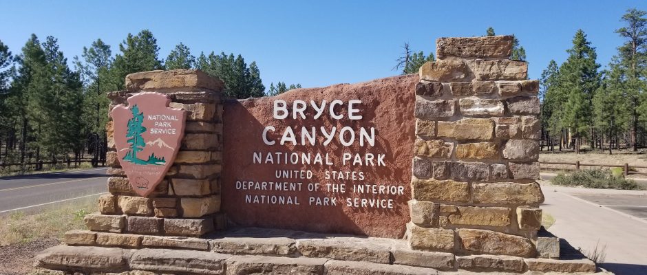
Bryce Canyon National Park

July 08, 2018
Fairyland Point

The Fairyland Point viewpoint gives a view into Fairyland Canyon, home to geologically younger hoodoos, some of which rise to virtual eye level from this vantage point.

Queen’s Garden Trail
The 1.8-mile Queens Garden Trail is one of the most popular hiking routes into the canyon.


Descending 320 feet from the rim into the heart of the Bryce Amphitheater, you will pass a number of hoodoos that resemble garden figures

and fixtures before arriving at a spur trail leading to a hoodoo seemingly carved into the regal shape of Queen Victoria.

The wide trail gradually narrows as it reaches Victoria’s wooded and hoodoo-filled “garden.”

Navajo Loop Trail

The popular Navajo Loop Trail starts at Sunset Point and drops 550 feet into the Bryce Amphitheater, passing through the cool, dark and narrow Wall Street canyon and the Silent City of hoodoos along the way.

You come to a formation known as Two Bridges.


Steep in places, the Navajo Loop has some unstable footing, so hike with caution; three major rock slides have occurred on this trail in recent years.

Thor’s Hammer

Avengers fans, assemble! Apart from Queen Victoria, Thor’s Hammer is the most famous hoodoo in Bryce Canyon and its most easily identifiable. This large, square-topped hoodoo towers above the Silent City section of hoodoos in the Bryce Amphitheater, and is quickly spotted from Sunset Point. You can also see Thor’s Hammer from the Navajo Loop Trail.
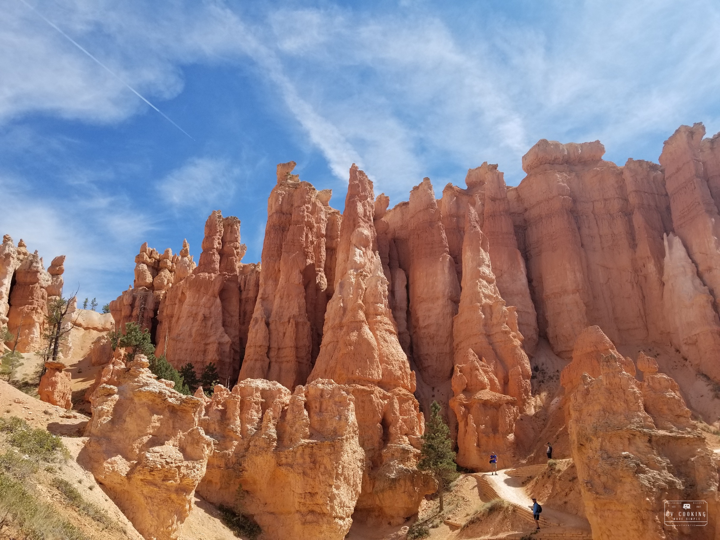
Bryce Amphitheatre
Roughly stretching from the vicinity of the Bryce Canyon Visitor Center to Bryce Point, the Bryce Amphitheater is the central feature of Bryce Canyon National Park. This spectacularly eroded section of the Paunsaugunt Plateau is home to the park’s famous rows of “hoodoos” — human-like rock spires — and is the focal point for the park’s most popular scenic overlooks, including Sunrise and Sunset points. Carved from the Pink Cliffs that give the features here their distinctive colors, the Bryce Amphitheater can be explored via a pair of the park’s most popular hiking trails: the Queen’s Garden Trail and the Navajo Loop Trail.
Sunrise Point

The views from Sunrise Point, whether you’re actually here to see the sun rise over the Bryce Amphitheater or visiting any time of day, are awe-inspiring.
In the foreground, you’ll see row upon row of Bryce’s famous “hoodoos” — tall, thin columns and rock spires eroded from the edge of the plateau you are standing on.
Eventually, the ground you are standing on at Sunrise Point also will erode to create more hoodoos — in fact, the Paunsaugunt Plateau crumbles away at a rate of two to four feet every century. Clinging to the edge of the canyon with their roots exposed are hardy limber pines, while the Ponderosa pines so common above the rim thin out rapidly as you descent from Sunrise Point via the popular Queen’s Garden Trail.
Chinese Wall


Narrow and full of holes, the China Wall (or Chinese Wall) in Fairyland Canyon is a good example of a Bryce Canyon National Park fin, also called a wall. These structures are formed by water runoff and “frost wedging,” where water seeps into cracks in the rock, then melts and freezes — an ongoing process that slowly but steadily weakens the sandstone.
Looking carefully at the China Wall, you can see that the parts furthest from the canyon edge are mostly hoodoos, while those closest to the rim (and thus more protected) have fewer hoodoos and more windows. The windows are smallest in the parts of the wall closest to the rim, but in time these too will widen and eventually collapse into hoodoos and rubble.
The China Wall is best viewed from the Fairyland Loop Trail. The formation gets its name from its prominent position atop a small ridge, which some observers say bears a resemblance to the Great Wall of China.
Swamp Canyon Viewpoint

Nobody would really confuse Swamp Canyon with wetlands, but with a spring and a pair of small creeks, it is wetter than most parts of Bryce Canyon National Park.
The canyon is wedged between fins and hoodoos and can be viewed from the Swamp Canyon overlook; you can hike down to the canyon from here.
Fairview Point

Farview Point easily lives up to its name with its long-distance views: from here you can look out over the Dixie National Forest to the Grand Staircase, with such landmarks as the Pink Cliffs of the Aquarius Plateau, the White Cliffs of Molly’s Nipple, and perhaps even the Kaibab Plateau, where the North Rim of the Grand Canyon resides. To the south, look for Navajo Mountain.
Natural Bridges Viewpoint

Like Bryce Canyon’s hoodoos, the park’s natural arches are formed by erosion: water seeps into cracks in the rock, and constant freezing and thawing — plus chemical dissolution of the sandstone by slightly acidic rain water — weakens the center of the rock. Gravity does the rest, pulling down the weaker middle section to form a window or arch.
From this overlook you can peer down into the canyon to see Natural Bridge, just one of Bryce’s natural arches, standing in deep red contrast to the Ponderosa pine forest below. More delicate than they look, arches like this can collapse at any time as water continues to do its slow but steady job of weakening the structure.
Agua Canyon Viewpoint

Any number of the hoodoos of Bryce Canyon have been given names associated with their appearance over the years, and at the Agua Canyon viewpoint you can see two of the more distinctive ones: The Hunter and The Rabbit. Can you see why these formations got their names? If you don’t see a rabbit, by the way, the alternative name for that hoodoo is The Backpacker — maybe that works better for you?
The naming of hoodoos goes back to the early days of Bryce Canyon National Park, when it became something of an obsession among park officials. Over the years, however, erosion has changed the appearance of many of the named hoodoos, so that they no longer resemble their names. As a result, giving official names to hoodoos has fallen out of favor, although you’re certainly welcome to give your own names to your favorites.
Ponderosa Point

Ponderosa Canyon is filled with a forest of Ponderosa pines, some of them 150 feet tall, which find a comfortable home in the park’s higher elevations. In addition to thriving in this canyon, the Ponderosa pines also dominate the landscape along the rim of Bryce Canyon’s northern section.

This viewpoint also offers a good look at the differing geology and biology of the White Cliffs and the Grey Cliffs that comprise, along with the Pink Cliffs, the bulk of Bryce Canyon National Park. The White Cliffs consist of slickrock sandstone with little or no soil, and tend to be devoid of plant life. Above this layer of rock, however, the Grey Cliffs — made of rock that was once sand, shale, or clay — offers a better foothold for plants, and thus have more vegetation. Interestingly, the harder White Cliffs erode faster than the softer Grey Cliffs because the latter’s plant life protects the rock against erosion from flash flooding.
Rainbow and Yovimpa Viewpoints
The wooded, high-elevation Rainbow Point you get a nice view of the Pink Cliffs, the ancient sandstone formation that gives birth to Bryce Canyon’s famous hoodoos.


The short path to Yovimpa Point offers another perspective on the Grand Staircase and several of its steps: the Pink Cliffs you’re standing on, the Grey Cliffs below the overlook, and the White Cliffs in the distance, marked by the 7,264-foot peak known as Molly’s Nipple. Also visible from Yovimpa Point are the distant red rocks that comprise the Vemilion Cliffs and, even further off, the Kaibab Plateau where the north rim of the Grand Canyon is located.


Black Birch Canyon Viewpoint

The Black Birch Canyon viewpoint is a pullout off of the main park road just north of Rainbow Point and Yovimpa Point — the southernmost viewpoints in the park. Among other things, you’ll get a nice view of Rainbow Point from the Black Birch Canyon pullout. Down below the 8,750-foot viewpoint are rows of hoodoos.
Paria Viewpoint

Why does one Bryce Canyon hoodoo get star billing at Paria View? It has to do with the angle of the sun: from this viewpoint you can see a single, castle-like hoodoo rising above all the others, and unlike the rest it shows its face directly to the setting sun.

The viewpoint overlooks the Paria Canyons, which are part of the Paria River’s watershed; the canyons were carved by water runoff when this part of Utah was a much wetter place, and flash floods can still occur here during thunderstorms. Not for nothing did the Paiutes name this “Paria,” which means “water with elk” or “water with mud.”
Bryce Point

For the most sweeping views of Bryce Amphitheater, head to Bryce Point:
Wall of Windows

(Picture from Bryce Point)
The Wall of Windows is a long, narrow rock formation comprised of hoodoos and a series of arches in the Bryce Amphitheater: as the name suggests, hikers on the Peek-a-Boo trail can look through the window-like holes in the rock. The contrast between the red rocks and the deep blue sky visible through the windows makes for an irresistible photo opportunity.
**************************************************************************************************************
This post contains affiliate links, so I make a small commission if you purchase through my links – that support helps to keep this blog running.
Copyright Foodie Made Simple, LLC. All text, recipes and photographs are copyrighted and may not be published elsewhere without express permission. Pinterest, Twitter, Instagram, Tumbler, Google+ and Facebook users, you are welcome to “pin” photos! re-tweet and “share” links all you like, just don’t copy the recipes themselves. Fellow bloggers are welcome to repost my recipes, just write the recipe in your own words, use your own photograph, then link back to the original recipe on rvcookingmadesimple.com


Comments are closed.