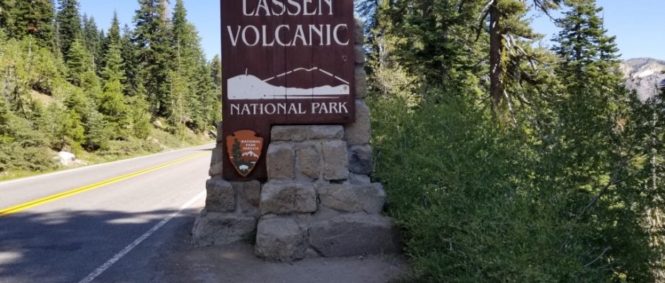
Lassen Volcanic National Park

August 2, 2019
Lassen has a rich natural and human history. Before settlers arrived to Lassen, the area was inhabited by people from four tribes: the Maidu (in the area south and east of the park), Atsugewi (who used park lands north and northeast of the peak as summer hunting, camping, and fishing ground), the Yana and the Yahi (in the foothills to the west). But with the discovery of gold in California, the area drew white settlers to the area and who drove out the native tribes. The settlers established pioneer trails along the current park boundaries, including the Nobles Emigrant Trail and the Lassen Trail.
Native Americans disappeared by the late 1800s, although there are still native Atsugewi that live in the area. They left artifacts behind, many of which are be displayed in the Loomis Museum, along with replicas of baskets and hunting tools. There are tribal descendants who still live in the area and are valuable partners to the park. They have contributed a great deal to the park to this day and participate in public programs in the summer.
Lassen Peak was a major landmark to the early settlers. It had a few names – it was called San Jose by Captain Don Luis Arguello, Mt. Joseph by the famous explorer Jedediah Smith, and later people knew it as Snow Butte. In 1841, a government exploring party named it Mt. St. Joseph. The name Lassen came from the area rancher Peter Lassen, who lived in the area in the 1840s.
In 1905 Theodore Roosevelt named the area the Lassen Peak Reserve. It was at that time that people requested the area become a national park. Preservation efforts resulted in the declaration of the peak and the Cinder Cone as national monuments to further conservation. Lassen Volcano then erupted in 1914 and 1915, even though it was thought to be extinct. Further efforts were made to protect “America’s only active volcano” and the area was declared a national park by Woodrow Wilson in 1916.
August 2016 marks Lassen’s 100th anniversary. It was the 15th National Park to be establish in the US, making it one of the oldest in the country.
Volcanic Legacy Scenic Byway
Drivers with a fear of heights should probably cede the wheel and take a backseat for the trek up the Volcanic Legacy Scenic Byway at this mountainous California park. Branching off the main entrance route from Mineral, California, near the southwest portion of the park, the byway takes you to the park’s primary visitor center before twisting and turning along a vertical climb up into the mountains and dormant volcanoes. Along the way, you’ll peer down into deep valleys and up at the park’s namesake volcano, Lassen Peak. The road also cuts directly through one of the park’s most active thermal areas, with bubbling mudpots and steaming streams on either side of the road. One of the best viewpoints is Manzanita Lake, which the road runs directly alongside. Park the car and pop out for show-stopping views of mountains reflecting in the lake’s crystal-clear waters.
Kohm Yah-mah-née Visitor Center


(40.437218, -121.533432)
The Kohm Yahmahnee Visitor Center is the official visitor center for Lassen Volcanic National Park, and is located at the southwest entrance of the park.
The 30-mile Lassen Volcanic National Park Highway offers and excellent introduction to the park. For a more in-depth auto-tour, pick up the Road Guide ($7.00) to Lassen Volcanic National Park at the Kohm Yah-mah-nee Visitor Center.
Sulphur Works

(40.44775, -121.535700)


Have a safe hydrothermal experience at a roadside fumarole (steam vent) or surround yourself in the gurgling symphony of boiling mudpots at the park’s most easily accessible hydrothermal area.


Brokeoff Mountain


(40.263840, -121.311056)
Lassen Peak


Emerald Lake


Bumpass Hell Overlook

(40.466168, -121.514127)
Can you spot the former Brokeoff Volcano, also known as Mt. Tehama, in the volcanic remnants that surround you?


The nearby boulder tells the story of this massive volcano’s destruction.


Lake Hellen

(40.467038, -121.509261)
You van visit what’s considered to be the snowiest place in California without ever leaving the road (although you should if you can). Lake Helen is located at an elevation over 8,000 feet, and covered in snow and ice for most of the year (up until mid-August). Throughout the winter, Pacific storms bring massive amounts of snow to the lake; snowfall usually totals around 600-700 inches.


Lake Helen is located at the south flank of Lassen Peak and can be seen directly from the park road, which runs along its southern and eastern shores. The lake is incredibly blue, a product of the high mineral content of the water.

It’s also incredibly deep, reaching depths of around 110 feet. Those brave enough can dip their toes in or wade, but remember that because of the high elevation and persistent snow and ice, lake temperatures can be as cold as 35 degrees.
Lassen Peak Parking Area and Viewpoint

(40.474054, -121.505458)


Experience the majesty of Lassen Peak (10,463 feet) the southernmost volcano in the Cascades., from the highest point on the park road at 8,512 feet.
Kings Creek Picnic Area
Kings Creek Picnic Area is accessible off the main park road and is a great place to stop for those exploring the park by car. The picnic area has level parking, handicapped-accessible restrooms, and picnic tables.


Kings Creek lies 17 miles from the northwest entrance, about 12 miles from the southwest entrance, and is also the start for a few different trails. The view is pretty nice from the picnic area as well, so don’t leave your camera in the car.


Kings Creek Meadow Scenic Pull-out


(40.460538, -121.459746)

Get your camera ready for this scenic spot where Kings Creek meanders through an expansive meadow at the foot of Lassen Peak. You can take a 1.8 mile one way hike to Kings Creek Falls through the meadows.
Devastated Area

(40.516002, -121.465416)

Devastated Area is an interpretive trail that stretches .25 miles one-way, making a short .5 mile round trip for those looking for a simple, easy, and scenic (this area has great views of Lassen Peak) walk. The loop is paved, wheelchair-accessible, and flat.


Interpretive plaques offer information on the lasting effects of the eruptions that have occurred on Lassen Peak. The trail can be followed in either direction.


Hot Rock
(40.535108, – 121.491474)
In May 1915, a Lassen Peak eruption triggered a giant mudflow. The Hot Rock is a huge piece of dacite lava that was carried 4.5 miles from the volcano crater to the valley during the mudflow. There are a few of these “hot rocks,” but this is the best-known: it’s located next to the park road, a little east of Lassen Peak.


The rock weighs about 300 tons and is smooth and black; it got its name from the fact that it was still sizzling 40 hours after it ejected from the crater. An interpretive sign offers additional information about the history and geology of the rock.
Chaos Crags and Jumbles Scenic Pull-out
(40.541819, -121.543045)
Look for this pull-out on the north side of the road about a half-mile after you emerge from the forest.

The Chaos Jumbles are the remains of a huge debris avalanche that occurred on the steep slopes of the nearby Chaos Crags, characterized by grey and pink scree. The lack of soil and vegetation here suggest that the avalanche deposits are not old, and none of the trees on the slide are more than 300 years old.

The Chaos Crags are excellent examples of geological features called plug domes. Plug Domes are short, steep cones that form when lava flows are super thick and viscous – almost toothpaste-like.
Lassen Peak is only two miles away and tends to dominate the scenery, so the crags are sometimes overlooked. But they’re worth a visit, as their age suggests ongoing geologic activity — and simply because they are quite striking against the barren Chaos Jumbles
Loomis Museum


(40.536585, -121.561964)
Located next to picturesque Manzanita Lake the historic Loomis Museum is open during the summer months. This accessible facility offers exhibits, an auditorium which features the park film and a Lassen Association educational bookstore. All profits from the bookstore go directly to the park. Rangers offer ranger-led programs in the summer and provide information and park publications. Exhibits include photos from B.F Loomis who documented Lassen Peak’s most recent eruption cycle and promoted the park’s establishment. Additional exhibits include the original equipment Loomis used to document the eruptions and traditional Atsugewi basketry.


From the museum you can pick up the trail around Manzanita Lake for amazing views of Lassen Peak or cross the road to take a walk along the Lily Pond Nature Trail.
****************************************************************************************
This post contains affiliate links, so I make a small commission if you purchase through my links – that support helps to keep this blog running.
Copyright Foodie Made Simple, LLC. All text, recipes and photographs are copyrighted and may not be published elsewhere without express permission. Pinterest, Twitter, Instagram, Tumbler, Google+ and Facebook users, you are welcome to “pin” photos! re-tweet and “share” links all you like, just don’t copy the recipes themselves. Fellow bloggers are welcome to repost my recipes, just write the recipe in your own words, use your own photograph, then link back to the original recipe on rvcookingmadesimple.com


Comments are closed.